The Great Divide: Understanding How Geography Influences Political Boundaries
November 16, 2024

Geography has been a significant influence on the shaping of political boundaries throughout history. It dictates not only the physical landscape of nations but also their governance, culture, and economic relations. From the rugged terrains of the Himalayas to the expansive plains of the Great Plains, the natural world has played a massive role in how countries are divided and how they interact.
**Historical Context**
The historical context of political boundaries is essential to understanding their current configuration. The maps we see today are the result of centuries of war, treaties, settlement patterns, and colonization. For instance, the borders of many African nations were drawn during the Berlin Conference of 1884-85, often ignoring ethnic and tribal lines to suit European powers. On the other hand, countries such as Japan are defined by natural barriers, such as mountains and seas, making it easier to maintain a cohesive national identity.
—
**1. The Role of Natural Barriers**
Natural features like rivers, mountains, and coastlines have long served as boundaries. These elements create physical divides that can influence not only where borders are drawn but also how nations develop. For example:
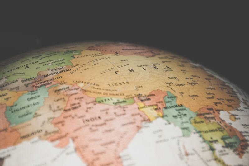
– **Mountains**: The Himalayas serve as a natural barrier between India and Tibet, impacting economic interactions and political relations. The rugged terrain makes cross-border movement difficult, establishing de facto boundaries that differ from official maps.
– **Rivers**: Many international borders are defined by rivers. The Rio Grande serves as the U.S.-Mexico border, while the Danube runs through multiple European countries, influencing trade and connectivity in these regions.
– **Oceans and Seas**: Coastal nations benefit from easier trade routes and fishing opportunities, shaping their political focus toward the sea and maritime laws, while landlocked countries often struggle with access to global markets.
—
**2. The Influence of Climate Zones**
Climate also plays a crucial role in politics and economy. Different climate zones have distinct agricultural prospects and resource distributions.
– **Tropical Regions**: Countries in tropical areas often depend on agriculture and resource extraction. Political boundaries here can be influenced by the availability of fertile lands, as seen in parts of Central America, where fertile volcanic soils dictate settlement patterns and agricultural policies.
– **Arctic Regions**: As climate change accelerates ice melt, countries in the Arctic are creating new political dialogues over resource rights and access. The geopolitical dynamics are shifting as nations look to stake their claims over newly accessible waters and resources.
—
**3. Cultural and Ethnic Influences**
Geography often influences cultural identities, which in turn can affect political boundaries. Ethnic groups settled in specific regions can lead to conflicts or cohesion. Take the case of the Kurds:
– **The Kurdish Issue**: The Kurdish people inhabit areas across Turkey, Iraq, Syria, and Iran. Their quest for an independent state is complicated by the fact that their inhabited lands span several borders without political recognition.
– **Cultural Landscapes**: In Europe, distinct cultural regions often coincide with geographical features. The Basque region straddles the borders of Spain and France, where a unique language and cultural identity have given rise to political movements advocating for greater autonomy or independence.
—
**4. Geopolitical Strategies and Historical Conflicts**
Political boundaries are frequently redrawn following conflicts and wars, with geography providing strategic advantages. The use of natural obstacles during wartime can fervently influence subsequent political boundaries. Examples include:
– **World War II**: Following the war, many European borders were redefined due to the geographical realities exposed during the conflict and the decisions made at treaties such as Yalta.
– **The Cold War**: Geography played a crucial role in the Cold War’s politics, where nations were divided not only by ideological beliefs but by their physical placement—for example, Berlin’s division into East and West, defined by both geographical and political lines.
—
**5. Modern Technology and Changing Geography**
In the modern era, technologies like satellite imaging and GPS have made it easier to study and redefine geographical boundaries. With globalisation reshaping economies and cultures, physical boundaries are becoming increasingly blurred:
– **Digital Borders**: The rise of the Internet and social media has created virtual communities that often transcend political boundaries, leading to the emergence of global citizenship and calls for the reevaluation of how we define national borders.
– **Environmental Policies**: Climate change negotiations have added new layers to political discourse, emphasizing collaboration across borders in tackling global issues that affect countries differently based on their geographical attributes.
—
**Conclusion**
The influence of geography on political boundaries is an intricate web of historical context, natural landscapes, cultural identities, and modern technology. Understanding this relationship is vital for grasping current global affairs and conflicts. The boundaries that define nations are not merely lines on a map; they resonate with stories of past struggles, cultural complexities, and ongoing debates over identity, territory, and governance. As we move forward, the challenge will be to reconcile geographical realities with the political structures that shape our world.
**Note:** As our world grows increasingly interconnected, the need for effective dialogue that transcends these geographical boundaries will only be more crucial in resolving conflicts and fostering collaboration.
—
By understanding and appreciating the geographical influences on political boundaries, we gain insights into the conflicts and collaborations that shape the future of our global society.


